Precision Underwater – Measuring and Navigating as a Swarm

Linus Kuster
06. enero 2026
06. enero 2026

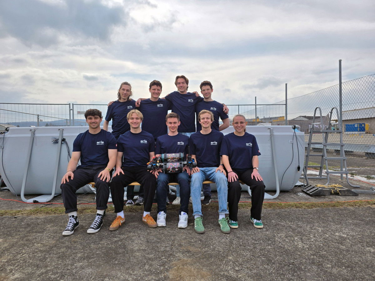
Autonomous underwater vehicles that do not work alone, but measure and navigate as a coordinated swarm: this was precisely the goal of SWARM, a focus project at the Department of Mechanical and Process Engineering at ETH Zurich. It was realised in collaboration with the Academic Space Initiative Switzerland (ARIS).
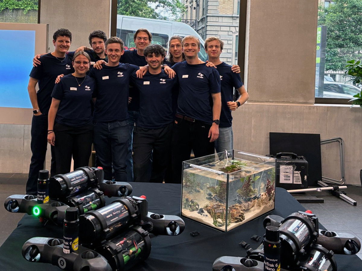
ARIS is a student association in which students develop technologies for space and other complex environments. Systems that have to function where conventional technology reaches its limits. SWARM transfers this requirement to the underwater world: robust, intelligent robot systems for research missions in Swiss lakes.
Commitment to the environment and research
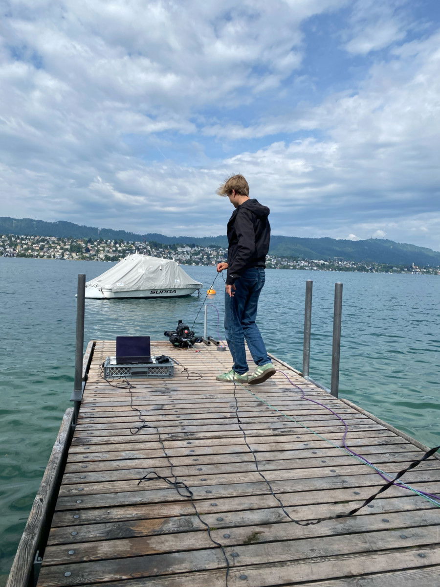
In collaboration with Eawag, the Swiss Water Research Institute, a mission was designed: several autonomous underwater vehicles dive simultaneously into a lake, at depths between 5 and 30 metres, and record measurement data there. The aim is to map water quality in three dimensions. Among other things, this will provide a better understanding of the spread of antibiotic-resistant bacteria.
The advantage of a swarm lies in its simultaneous coverage. Instead of taking measurements one after the other at individual points, a dense, synchronous measurement area is created. This allows anomalies to be identified, hotspots to be located and possible sources of pollution to be narrowed down.
For this to work, each vehicle must know exactly how deep it is at all times.
Why depth is the decisive factor
There is no GPS underwater. An underwater robot cannot simply check its position on the surface. Instead, pressure becomes the most important orientation factor.
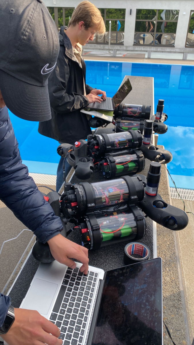
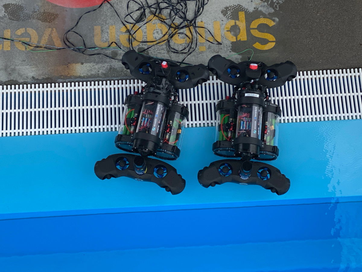
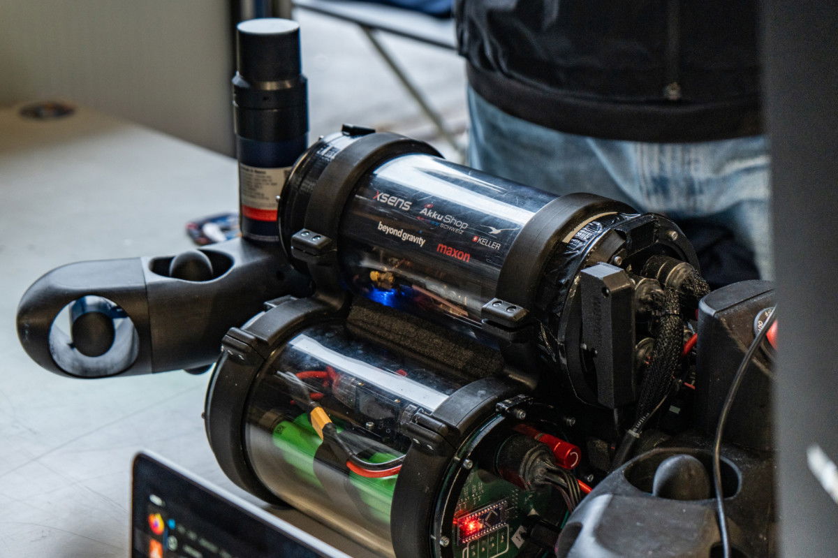
The SWARM project used PAA-9LX, 4bar pressure transmitters from KELLER Pressure. These sensors are located in the watertight hull of the vehicles and measure the ambient pressure. The current depth is calculated in real time from this pressure.
To put it simply, the robot uses the pressure to sense how much water is above it – and thus knows very precisely whether it is at a depth of 12.2 metres or 13.0 metres, for example.
The depth information flows directly into the autonomous control system. The vehicles continuously compare their target depth with the current depth and actively correct their position using their propulsion systems. In this way, several vehicles can remain in the same water layer at the same time and collect comparable data. Depth thus becomes the basis for orderly swarm movement.
Without stable, precise pressure measurement, this type of coordinated mission would not be possible.
Collaboration with KELLER Pressure
KELLER Pressure not only supported SWARM with hardware, but also acted as a true technical partner. The integration of the pressure sensor, clean signal transmission and data evaluation under real conditions, in the pool and in the lake, were developed jointly.
The result was remarkable:
- The vehicles were able to dive in a controlled manner and maintain their depth without manual intervention.
- The depth measurement was stable enough to allow several robots to operate simultaneously in the same layer.
- The collaboration was direct, pragmatic and fast, which is crucial for a student project with a tight schedule.
- For ARIS, which implements complex technology projects with student teams every year, this type of partnership is central: industry that not only supplies parts, but also shares knowledge.
From SWARM to POLARIS
Student development projects run for one year. Even though the SWARM 24/25 project has now been completed, the idea lives on. The follow-up project, POLARIS, is being developed within ARIS. This new focus project is developing an autonomous system for operations under the ice of an alpine lake, such as in St. Moritz.
The goal: to map the thickness of the ice layer. With higher resolution than previously possible, completely autonomously and without humans having to enter dangerous areas.
The depth information provided by the pressure sensor plays a central role here. Not only is it crucial for navigation in an extreme environment with limited visibility and difficult access, but it also forms the basis for calculating the ice thickness. This is determined by the difference between the absolute depth of the underwater robot and the distance to the underside of the ice layer.
From lakes to beneath the ice sheet: students develop technologies for extreme environments.
Compartir
«With KELLER Pressure, we have a partner who not only supplies us with high-precision sensors, but also develops solutions together with us.»
Linus Kuster
Technical Lead Polaris